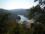
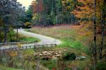
 Gorges State Park Lake Jocassee The southern boundaries of Gorges State Park run along the NC/SC state lines. In this picture most Lake Jocassee that can be seen is on the NC side of this line, and land surrounding owned by NC State Parks. This picture was taken several hundred feet outside of the eastern park boundary from private property. K. Bischof (2011-10-06) Request #16917 hi-res [3648 x 2736] | 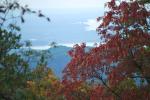 Gorges State Park Fall view of Lake Jocassee from Gorges State Park L. Johnson (2011-10-09) Request #16873 hi-res [2896 x 1944] | 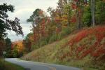 Gorges State Park Gorges gorgeous autumnal awesome view L. Johnson (2011-10-09) Request #16872 hi-res [2896 x 1944] | 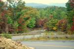 Gorges State Park Gorges gorgeous Fall S curves views L. Johnson (2011-10-09) Request #16871 hi-res [2896 x 1944] |
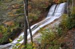
 Gorges State Park Gorges gorgeous Fall views L. Johnson (2011-10-09) Request #16870 hi-res [2896 x 1944] | 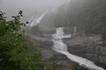 Gorges State Park Toxaway Falls An erie evening on the Toxaway. The park boundary runs along the east side of most of this falls. Towards the base of the falls Gorges State Park boundary crosses the river to encompass the full river. K. Bischof (2011-09-04) Request #16858 hi-res [4288 x 2848] | 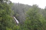 Gorges State Park Upper Bearwallow Falls K. Bischof (2011-09-06) Request #16857 hi-res [3985 x 2655] | 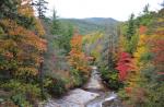 Gorges State Park Bearwallow Valley K. Bischof (2011-10-09) Request #16856 hi-res [4112 x 2697] |
 Gorges State Park Upper Bearwallow Falls Bearwallow Creek. K. Bischof (2011-10-09) Request #16854 hi-res [4108 x 2684] | 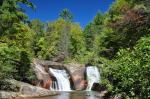 Gorges State Park Twin Falls Toxaway River K. Bischof (2011-10-01) Request #16853 hi-res [4288 x 2848] | 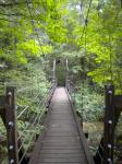 Gorges State Park Canebreak Trail/Foothills Trail Canebreak Trail bridge over Toxaway Creek. K. Bischof (2011-09-08) Request #16466 hi-res [2736 x 3648] | 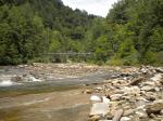 Gorges State Park Foothills Trail Foothills Trail Bridge crossing the Toxaway River at the head waters of Lake Jocassee. K. Bischof (2011-09-08) Request #16465 hi-res [3648 x 2736] |